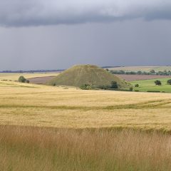
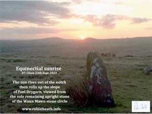
Autumn Equinox Sunrise at Waun Mawn standing stone

Just returned from a successful observation of the equinox sunrise taken from the sole remaining standing stone at Waun Mawn.

The time of the equinox astronomically was only an hour away from the sunrise, so this is the closest exactitude one could ever hopefully wish for, and as you can see, it affirms everything I’ve been proposing with regards this site’s most likely function.

This is the site in the Preseli Hills, where a prototype Stonehenge circle has recently been proposed, later transported to make the original outer ring of bluestones, at Stonehenge. See my discussion here.

The Original Bluestone Circle, yes or no?

Waun Mawn – is this the site of the Original Bluestone Circle?

a) How to find the site

The Waun Mawn sites are accessed from the B4229 Eglwyswrw to Haverfordwest road, along a gated farm track by the cattle grid at Tafarn y Bwlch ( Lat 51*58′; Long 4* 47′). During the recent Documentary The Lost Circle Revealed, shown on February 12th we saw evidence that supports the old folk legend that an original bluestone stone circle was once taken from the Preseli Hills of West Wales to Stonehenge. I would like to suggest some comments that may be useful in assessing this evidence and clearing up some unfortunate confusions that appear to have been made in the presentation of the material.

During the week following the documentary I  received and answered over 90 emails , and one of the main issues raised by these correspondences was a confusion as to just which of the involved stones formed the Waun Mawn referred to during the documentary. The OS map shows three separate areas where standing stones are marked. Below, I have included photographs of all three sites. The OS Map allocates this ‘title’ to the higher reaches of the prominent hill Cnwc y Hydd, yet there are extensive peat bogs down to the lower levels, and mawn means ‘peat’ in Welsh.

Continue reading “The Original Bluestone Circle, yes or no?”

Durrington Walls Pit Ring – Part Two

Part Two: Redefining the Stonehenge Landscape

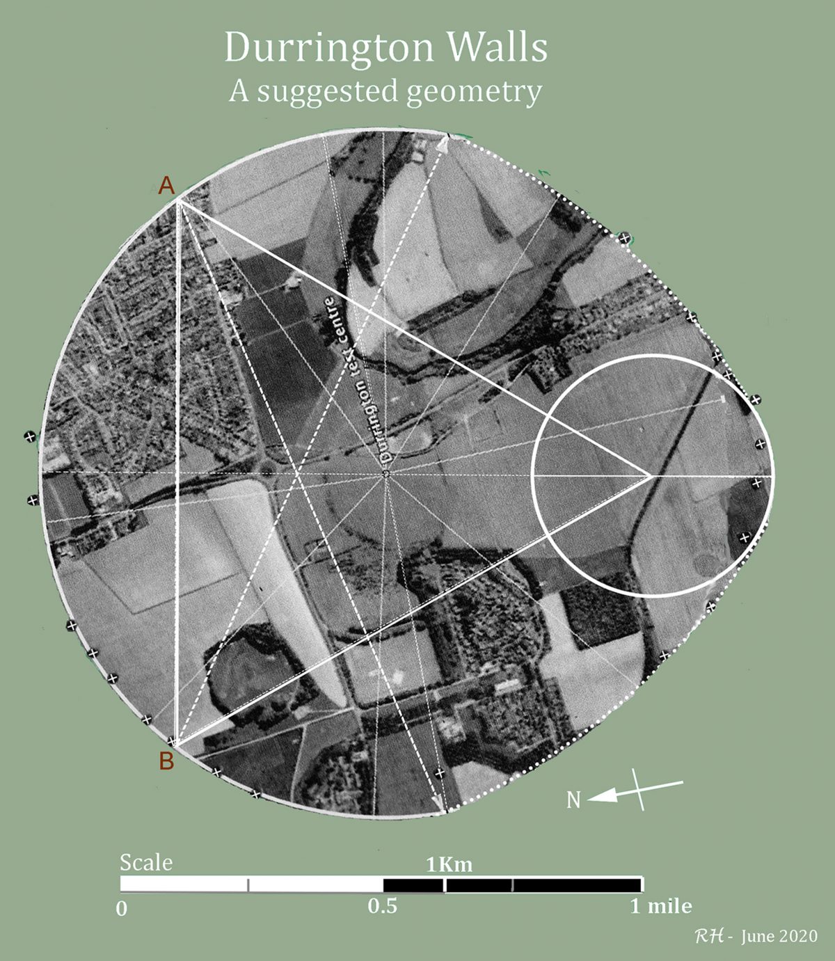
Durrington Walls Pit Ring is by far the largest known example of a megalithic egg, when compared with other existing types of ‘egg’, such as Woodhenge (Type II, Thom, 1967), just south of Durrington;  Allen Water, near Hawick,(Type I, Thom, 1967 ); and Castell Mawr henge in Pembrokeshire (Type III, Heath, 1916), adjacent to the ‘bluestone’ outcrops of Preseli, in West Wales. Other surviving examples of ‘Type III’ eggs, which have semi-elliptical ‘blunt’ ends, include Hirnant cairn circle in Montgomeryshire (Type III Hoyle, 1977), and Glasserton Mains rock art, on the Machan peninsula, Dumfries and Galloway (Morris and Bailey, 1967).

In Part One, the map of the pits around Durrington Walls was shown to clearly define the known geometry of a circular ended Type II egg, based on the locations of the many pits that make up the ‘pit ring’ discovery at Durrington. This geometry was compared with that of Castell Mawr.

Part Two shifts the focus to a metrological analysis of the shape of this pit ring, exploring its apparent properties and the relationship between Stonehenge and Durrington Walls pit ring ,  whose centre is located at a distance of just under 2 miles to the north-east of Stonehenge.

A New Circle around Stonehenge.

Stonehenge displays some similar qualities to the pit ring in that both monuments have identifiable centres and both have connections with megalithic constructions beyond their enclosing ‘walls’or ditch and bank, which extend out into the wider landscape. My earlier posts on Woodhenge provide a good example of such an extension to Stonehenge. Both monuments are also redolent with geometrical and metrological information, the kind of evidence that I routinely work with.

The investigation here identifies and quantifies these similarities, and  concludes by identifying a possible further large circle, concentric to, but set well beyond the present boundaries of Stonehenge’s bluestone, sarsen and Aubrey circles, and analysis will suggest a highly significant underlying purpose for such a circle’s existence. 

Continue reading “Durrington Walls Pit Ring – Part Two”
Exploring Durrington Walls Pit Ring

Part One:  Joining up the Dots

For pandemic reasons, the 2020 summer solstice sunrise gathering at Stonehenge was cancelled . The awesome sight of the rising sun over the Heel stone in line with the monument’s axis and the ‘avenue’ was replaced by an important discovery: A  huge ring of very deep and very wide pits had been discovered in the chalky subsoil around Durrington Walls, just two miles northeast of Stonehenge and a little north of Woodhenge.

The discovery of these pits is of great significance, and came in the form of a report of an on-going investigation report, the result of years of work by large team of archaeologists from many universities, and other specialists.

Due to the site’s proximity to Stonehenge – which is just under three miles to the southwest of Durrington Walls, the PR guys clearly thought it a good time to announce the launch at the summer solstice. The Guardian clearly thought so, coming on strong with this catchy title,

Vast neolithic circle of deep shafts found near Stonehenge : prehistoric structure spanning 1.2 miles in diameter is masterpiece of engineering, say archaeologists.”

Continue reading “Exploring Durrington Walls Pit Ring”

A NEW LANDSCAPE TEMPLE AT AVEBURY

An earlier shortened version of this article can be found on The Henge Shop website

StoneAgeSurveys

presents

For the Spring Brexinox, 2019

A Newly Revealed Temple at Avebury

The Avebury henge site was very nearly lost to us. We owe its existence to Alexander Keiller, the ‘Marmalade Millionaire’ who, during the 1930s, poured his family inheritance into restoring the site. Before Keiller, there were only eight original stones left standing at Avebury.

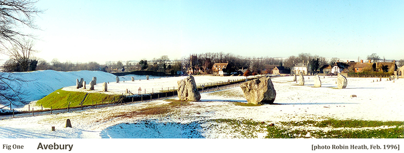
Avebury henge in the snow. The Henge Shop is at the centre, the Church just to its left.

During the early eighteenth century, the inhabitants of Avebury village became engaged in the wholesale toppling of Avebury’s huge stones and their subsequent reduction to building stone. If that great antiquarian and chronicler William Stukely had not publicly intervened, all of Avebury’s stones would have been removed and the site totally destroyed. A single generation would have demolished Avebury.

During Avebury’s darkest days, Stukely wrote,

‘And this stupendous fabric, which for some thousands of years, had brav’d the continual assaults of weather, and by the nature of it, when left to itself, like the pyramids of Egypt, would have lasted as long as the globe, hath fallen a sacrifice to the wretched ignorance and avarice of a little village unluckily plac’d within it.’  Continue reading “A NEW LANDSCAPE TEMPLE AT AVEBURY”

The Henge Shop launch their new E-magazine!

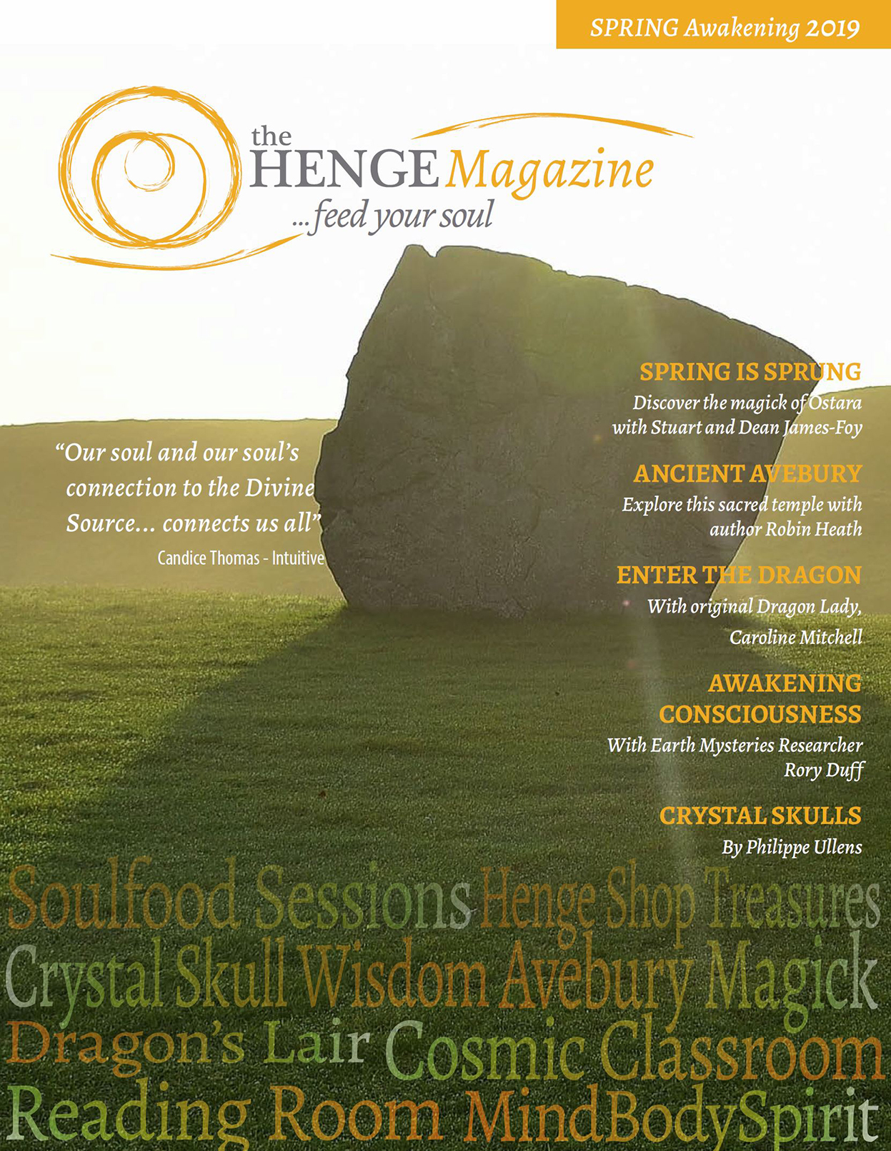
A copy of the first edition front cover is now available [see graphic below and try the link over the next day or two].  Within the covers of this first (and FREE) edition, due on-line on The spring equinox, (March 21st), I was commissioned by its editor, Naz Ahsun, to write an illustrated article on my latest research findings.  For those who are interested and/or attended my talk and mini-tour at the henge shop and within Avebury during the summer solstice of 2018,  you may now find the details I promised then.. which is… The identification and description of a previously unrecognised integrated temple monumental structure based on research undertaken during the past several years.  


Unless one takes account of the astronomy, geometry and measurements of a complex megalithic site like Avebury, one will never understand the integrated nature of these magnificent sites nor how they ‘talk’ to their neighbouring sites. There will shortly be more to follow on this website concerning this new material about Avebury…

A Sideways Glance at the recent ‘Breakthrough at Stonehenge’ news story.

For almost a century an often heated debate has rumbled on, following Dr H H Thomas’ discovery suggesting that many of the bluestones found at Stonehenge had originated in the Preseli Hills of West Wales. Various geologists and even some archaeologists (e.g. Burl) have suggested that these stones were not fetched to Stonehenge at ‘vast expense of toil’, but instead were transported by glacial action. They would tell you that the jury is still out on the matter of how the bluestones arrived at Stonehenge.

Some years ago, the quarry at Craig Rhos y Felin became the focus of work led by professor Mike Parker Pearson. The claim was made that some stones from this quarry petrologically matched a number of stones at Stonehenge. This work was duly written up in Antiquity, Volume 89 Issue 348 – contributors listed were Mike Parker Pearson, Richard Bevins, Rob Ixer, Joshua Pollard, Colin Richards, Kate Welham, Ben Chan, Kevan Edinborough, Derek Hamilton, Richard Macphail, Duncan Schlee, Jean-Luc Schwenninger, Ellen Simmons and Martin Smith. Continue reading “A Sideways Glance at the recent ‘Breakthrough at Stonehenge’ news story.”

Stonehenge – Woodhenge (Part Three)

THE PRESELI CONNECTION

PART THREE of the STONEHENGE – WOODHENGE tryptych

INTRODUCTION

Part One and Two of this tryptych revealed an unexpected geometrical relationship between the location of Stonehenge and that of its sister henge monument, Woodhenge. Part Three now expands this new evidence. By comparing data from the megalithic landscape around Stonehenge/ Woodhenge with that from the megalithic landscape in and around the Preseli Hills of West Wales a new type of connection emerges, one that links the ‘bluestone’ culture of the Preseli Hills of West Wales with that of the Wessex culture, specifically the Stonehenge landscape shown above (but perhaps even Avebury and elsewhere). Continue reading “Stonehenge – Woodhenge (Part Three)”

The English Lake District Stone Circles

A New Perspective

by Robin Heath

THE HISTORY OF THE STORY

The large number of stone circles found in the English Lake District of Northern Britain are among the oldest known, Aubrey Burl suggesting that the construction of Castle Rigg, its most visited ring as being ‘around 3200 BC’ [Burl 1995]. Many of these circles are in fact non-circular and most of the survivors are very large – over 100 feet in diameter. Their design geometry includes many of the ‘flattened circle’ geometries first discovered by Alexander Thom, [Thom, 1967], and which he named Type A and Type B flattened circles.

The Type A’s perimeter shape is based on hexagonal geometry, whereas the Type B is based on the division of a diameter line by three, which can be understood as based on a vesica piscis construction. These two types of flattened circle are fundamentally different.  However, examples have been found where a definite geometrical change has made to the standard design. One example of this is the Type D flattened circle, whose geometry will be explained later.

This article focusses on the locations of the major Lake District circles and their relationship to other megalithic sites in Britain. It demonstrates that knowledge of Astronomy, Geometry and Metrology were all subjects that fell well within the capabilities of the circle builders.

Continue reading “The English Lake District Stone Circles”

Stonehenge & Woodhenge – PART TWO

PART TWO – A SPECIAL RELATIONSHIP

In Part One a single action began a process of investigation – I made a measurement of two physical realities. The first was the length of a line connecting Stonehenge centre to Woodhenge, centre, and the second was the angle of orientation that this line makes with respect to an east-west line, termed a co-azimuth angle. This second part of the article shows where that single action can lead a researcher into understanding presently unsuspected purposes within the designs of, in this case, Stonehenge and Woodhenge.

Continue reading “Stonehenge & Woodhenge – PART TWO”