Stonehenge & Woodhenge – PART TWO

PART TWO – A SPECIAL RELATIONSHIP

In Part One a single action began a process of investigation – I made a measurement of two physical realities. The first was the length of a line connecting Stonehenge centre to Woodhenge, centre, and the second was the angle of orientation that this line makes with respect to an east-west line, termed a co-azimuth angle. This second part of the article shows where that single action can lead a researcher into understanding presently unsuspected purposes within the designs of, in this case, Stonehenge and Woodhenge.
Continue reading “Stonehenge & Woodhenge – PART TWO”

Stonehenge & Woodhenge – A Lost Legacy – PART ONE

  • PART ONE  –   A LOST LEGACY

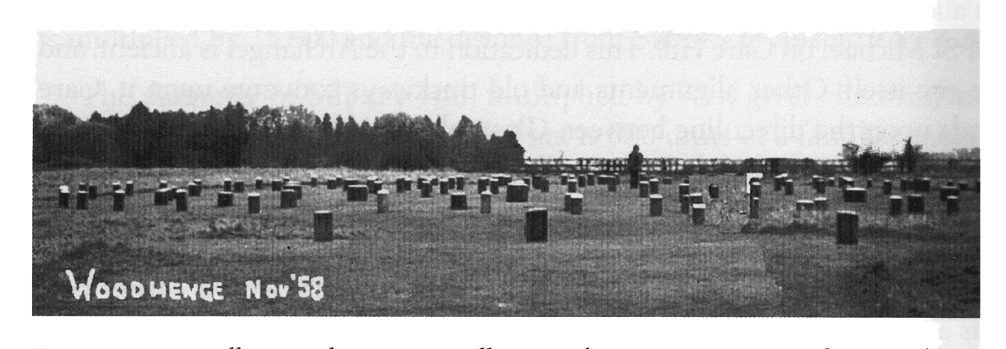
Soon after the distinguished Welsh archaeologist Maude Cunningham and her husband finished work excavating the site we now know as Woodhenge, in 1929, the locations of each of the site’s many revealed postholes were marked with grey concrete bollards. The best that can be said of this action was that it ensured their original exact positions were recorded for posterity (see Alexander Thom’s photograph below, from 1958, courtesy of Eoghann MacColl).

Visually, Woodhenge is neither a pretty nor an impressive site, unlike its nearest neighbour, Stonehenge, some 1.9 miles to the southwest. VIsitors to Woodhenge tend not to linger around this site, and soon slope off to nearby Durrington Walls, to the north, or Stonehenge, to the southwest. This article claims to lift the present Cinderella status afforded to this Neolithic class II henge and timber circle monument, by identifying a previously unrecognised significance in its geodetic placement with respect to Stonehenge.

Continue reading “Stonehenge & Woodhenge – A Lost Legacy – PART ONE”