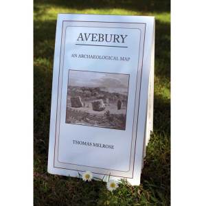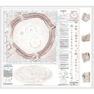
Designer and collator Thomas Melrose has done what has been needed for many years – produced a superb graphical map of Avebury where all the stones are listed, all the recent archaeological evidence derived from LIDAR and aerial photography is included and, where applicable, shown on the plan. For the tourist or visitor it now becomes the must-have source material to have tucked away in a rucksack or large pocket during a walk around the Avebury Henge site.
But this new presentational format goes far further than this necessary accessory. Its accuracy is without doubt the best yet available to researchers, be they academic archaeologists or enthusiastic amateurs.
Full details of the long explored shape and size of the Northern circles are shown, proving it was originally a ‘Type 1 egg’ (in the Alexander Thom nomenclature).
Avebury, the largest stone circle in the world, is now accurately mapped and available to all, to a scale of 1:875. meaning the Henge is shown nearly two feet across. The remaining surface area is extremely well utilised , displaying drawings of each of the remaining large standing stones numbered to the traditionally accepted ‘Isobel Smith’ convention.
A set of no less than thirty narrative legends are also listed, each explaining a feature marked on the map many of which are either not visible on-site and/or have enjoyed little publicity. This list includes stones that are now buried, or reduced to broken fragments from the stones smashed up during the time of ‘Stonekiller’ Robinson in the early 18th century, when we almost lost Avebury for all time.
The many sidebars are an invaluable aid to anyone who wishes to know what Avebury once was and what is has become. The covers of the map usefully contain two maps of Avebury village to orient the visitor unfamiliar to this remarkable site.
My only gripe is that the first edition of the map omits to show Thom’s 3-4-5 triangle, of side lengths 30,40 and 50 megalithic rods (2.5 megalithic yards of 2.722 ft or 6.805 ft.). This is a serious omission, for the three corners of this right-angled triangle mark the radius centers for many of the various arcs that make up the huge outer stone ring at Avebury. There is no other way that these arcs could have been defined. The publishers have taken note of this comment and later editions will adopt or otherwise include this feature as the first plan diagram in Thom’s first book, Megalithic Sites in Britain (OUP, 1967).
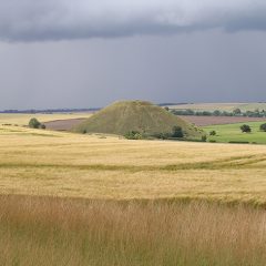
The map is beautifully hachured in fine brown ink with regular spot heights, so that the profile of the ditch and bank can be better appreciated. In addition an oblique view looking north from the direction of Silbury Hill is included and helpful. All this for just £10! A non-folded version is also available for framing or detailed analysis*. It made this reviewer very happy to see manifest what has been much needed for many years.
*Researchers can now measure the Avebury site for themselves, in order to check out the myriad of claims and theories that abound concerning this site. For example, we now know for sure that the northern inner circle once contained 27 stones, the southern circle 29 stones.
Considering the wrecked state of the monument, following its intentional destruction over recent centuries, the new map shows what the work Stukley, Keiller, Thom, Piggott, Thom, Burl and others have done, to reveal as well as is probably possible the original form of this grandest of British prehistoric monuments. It now remains to be seen whether academic archaeologists will be bold enough to inquire further into what Avebury may actually all have been for. With this map to work with, the truth is now out there, in plain sight.
by Robin Heath, November 2019
(this post may be republished but only as a whole, citing robinheath.info)


One thought on “Avebury: Review of the recent OS-style map”
Comments are closed.